
Resources introductory text goes here

Floods and Droughts Research Infrastructure (FDRI): A new 5-year capital investment by the UK Government enabling essential science and innovation to improve the country’s resilience to hydrological extremes.
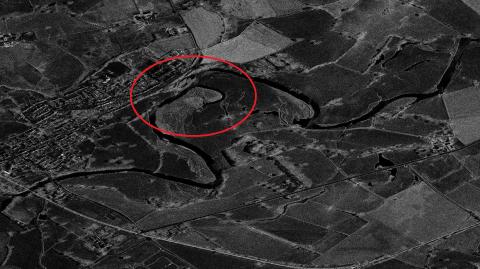
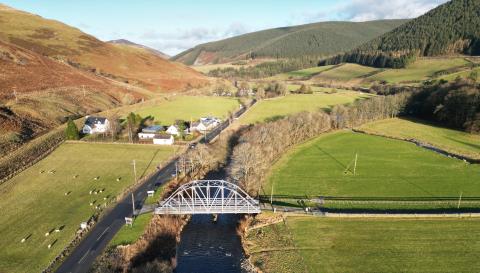
The FDRI team has been working with many of you to help understand the River Chess sub-catchment of the Thames basin. With this information we have created a perceptual model of the hydrological features and processes in the catchment.
The Environment Agency, with FDRI partners - the University of Bristol and the UK Centre for Ecology and Hydrology (UKCEH) - convened 48 experts for a national workshop in 2024. The workshop focussed on understanding catchment processes during drought conditions and identified the most urgent research priorities.

Two identical online, interactive workshops were held to understand user needs for finding and accessing data, focussed on five types of digital interface.
Across the two workshops we had 15 external participants, six additional UKCEH participants, as well as contributions from eight UKCEH colleagues who worked directly on FDRI.
About working with FDRI to develop collaborative PhD opportunities
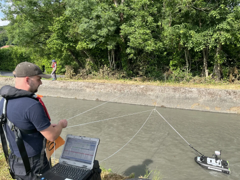
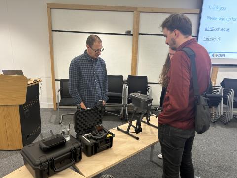
Tom Burton and Jasmine Hughes from FDRI WP1 Field team attended the ADCP Intercomparison event in France on 3 and 4 June 2025
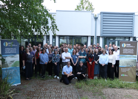
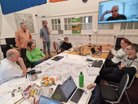
The FDRI team held its second annual meeting to share opportunities and challenges and connect across the project.
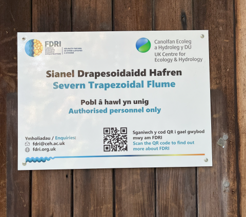
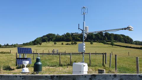
The FDRI project has reached a very exciting major milestone; on 19 May 2025 upgrades were added to the trapezoidal flume system in the Hafren Forest area of the upper Severn catchment, the first pieces of equipment installed under FDRI.
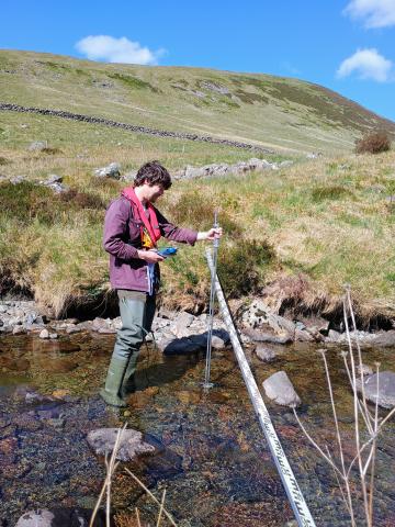
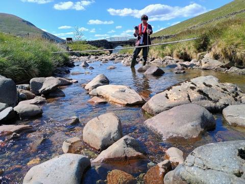
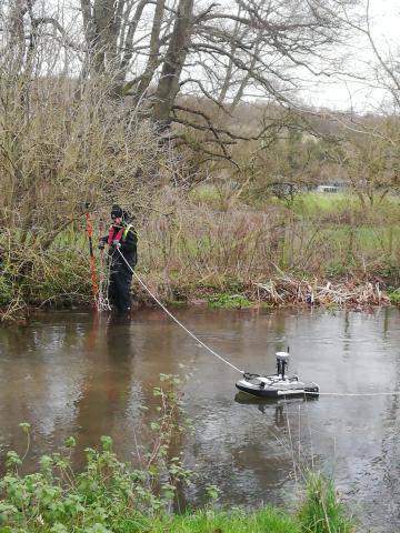
Rainfall across the UK has been abnormally low during spring 2025, with England experiencing the driest spring since 1961. This has led to exceptionally low river flows in north and mid-Wales, the north-west of England and Scotland, including in the FDRI study catchments of the Severn and the Tweed. This presented us with an excellent opportunity to get out into the field and monitor these low flows.

On May 8 and 14, the FDRI Digital team hosted successful online workshops focused on user interface design. We aimed to gain an understanding of how best to design the public interfaces to FDRI data including the landing page, data portal, and APIs and how to make them as accessible as possible to different user groups.
We were thrilled to have FDRI science highlighted at the European Geosciences Union (EGU) annual general assembly. Taking place from 27 April to 2 May in Vienna, this landmark event in the environmental research calendar welcomed over 20,000 scientists from 120 countries to share knowledge and new innovations in environmental science.
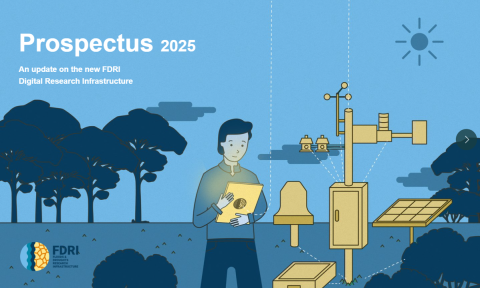
FDRI is excited to present our new digital prospectus. This outlines the upcoming work within the digital research infrastructure of FDRI, some of the data we will have available and the systems which are in development.

Developing novel tracer-based methods to investigate how pressures on upland wetlands alter flood and drought resilience
The project will investigate how land use and climate change pressures on upland wetland and floodplain systems, alter their role in modulating floods and droughts.
Join us for an online workshop on the development of the Flood and Droughts Research Infrastructure (FDRI) digital system user interfaces.

Being able to access and use a range of data related to the terrestrial hydrological cycle and associated risks (e.g. climate, meteorological, hydrological) is crucial for planning, analysis and management in sectors such as insurance, energy, agriculture, conservation, public policy, scientific research and many more. In this online course, students will learn to find, prepare, manipulate, analyse, model and present hydrological data in a series of skills-focussed workshops and seminars.
A range of representatives from research and higher education institutes came together to discuss the theme of sensor (meta)data models and their crucial role in ensuring accurate, reliable and FAIR observational data.

FDRI’s Digital Research Infrastructure will be an important part of what FDRI delivers.
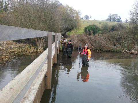
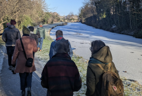
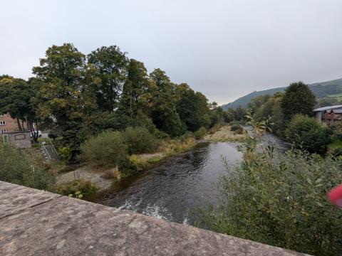
The RCA monitors the flow at various locations along the river on a regular basis, but can usually do one or two sites in a day due to the time-consuming nature of the process. The intensive gauging day was organised by the RCA to get a clearer picture of the “losing reach” of the Chess where the flow of water is less than upstream locations. We believe that a proportion of the water is being diverted away from the river in this area.

In February Prof Mike Bowes and Gareth Old (both representing FDRI from UKCEH) met with Prof Adrian Stanica (Lead of
We are actively building opportunities to advance the science of floods and droughts by engaging with the satellite remote sensing community.
The FDRI Community Advisory Group supports and shapes the development of FDRI.
In spring 2025 (dates to be confirmed), we will be hosting a series of online co-design workshops that will focus on the development of the User Interfaces (UI) of the new FDRI systems.
UKCEH Hydrometry Scientist Nick Everard spent a very cold but enjoyable day exploring potential FDRI streamflow monitoring sites on the River Tweed and its tributaries.
An interdisciplinary, participatory workshop, 'Re-Contextualising Hydrology: Aesthetic Explorations of Water + Data', took place on Friday 10 January at The Gregson Community Centre in Lancaster.
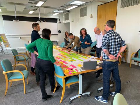
Working with major stakeholders in the area, we hosted two half-day workshops with major stakeholders in the Chess catchment to identify opportunities, challenges and data gaps which FDRI can address.
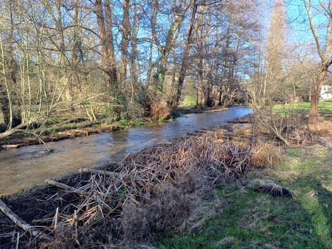
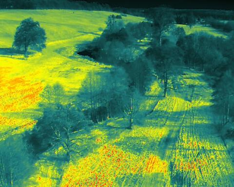
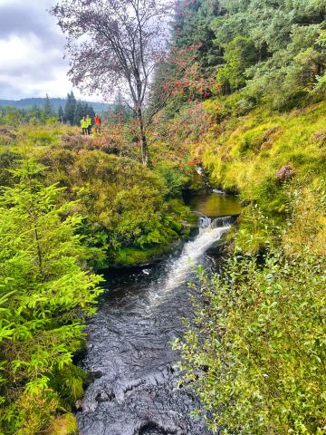
The UKCEH and BGS teams worked together to survey the Chess catchment, studying the physical features of the river and nearby terrain.
Are you interested in co-organising a FDRI community research workshop? We are looking for topic themes and co-hosts for future community research workshops.

We hosted our first FDRI community research workshop at the University of Bristol on 'Catchment processes during drought' on the 21 November 2024.

As a community informed project, we will be monitoring attitudes towards FDRI and how they change over time.
Recruitment for catchment champions on the Tweed, Severn and Chess (Thames) rivers
Rhaglen hirdymor arloesol a fydd, am y tro cyntaf yn y DU, yn monitro’r system hydrolegol gyfan, er mwyn gwella’r gallu i ymateb i lifogydd a sychder.


We have developed detailed knowledge and assessed the current scientific understanding of the selected sub-catchments, combined into perceptual models.
FDRI played a leading role in the recent British Hydrological Society National Symposium, convening sessions, running community workshops, leading the field trip and showcasing recent activity across the FDRI programme.
