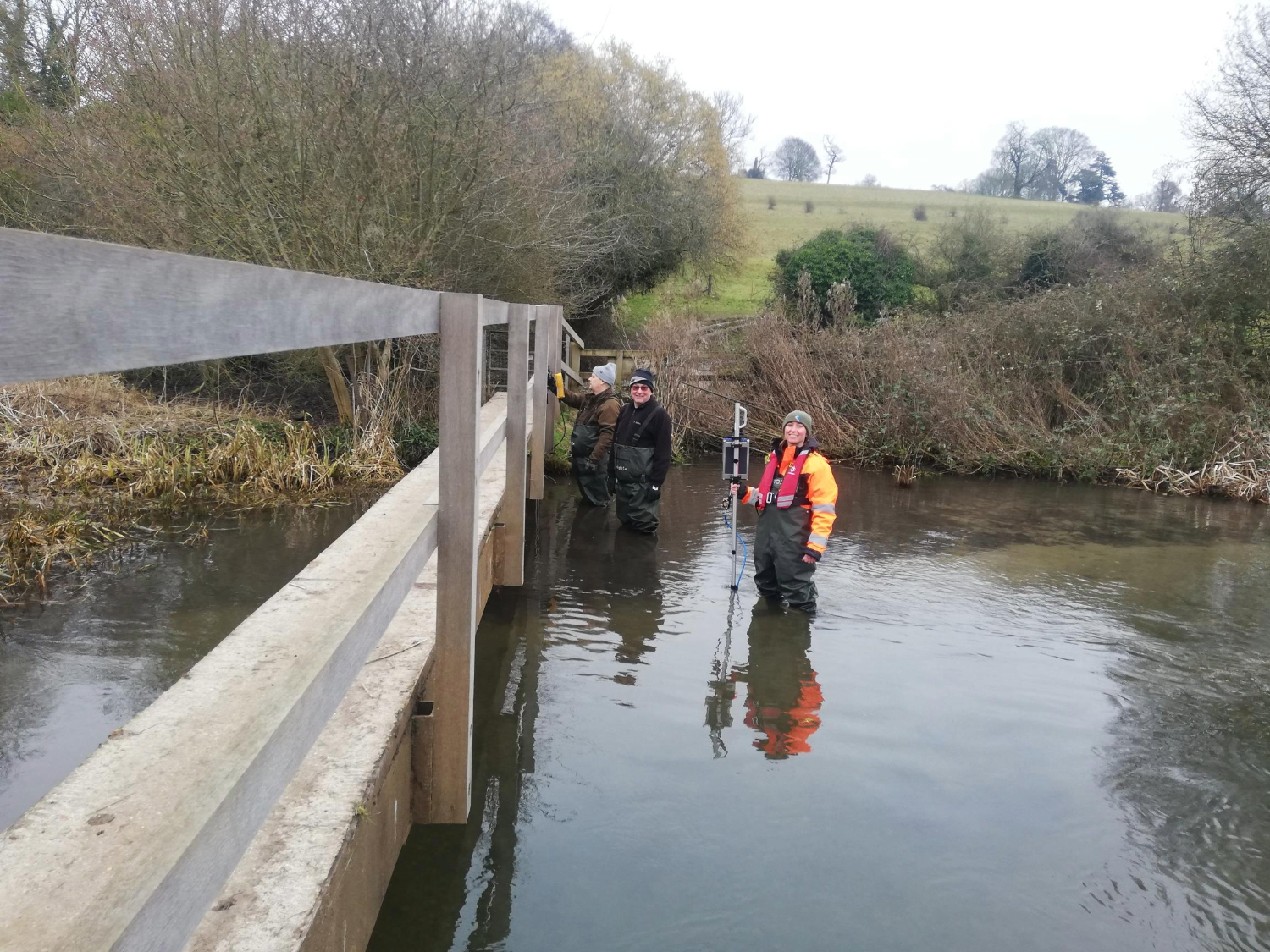
The River Chess Association (RCA) monitors the flow of the River Chess at various locations along the river on a regular basis but can usually do one or two sites in a day due to the time-consuming nature of the process. An intensive gauging day was organised by the RCA on 13 March 2025 to get a clearer picture of the “losing reach” of the Chess where the flow of water is lower than in upstream locations. We believe that a proportion of the water is being diverted away from the river in this area. 

FDRI field technician Jasmine Hughes was able to join the RCA with the aim of gathering information about the sites. Together, the RCA and FDRI conducted flow gauging at 8 locations. 

A graph showing the 15% loss of flow of the River Chess between Crestyl Farm and Sarratt Concrete Bridge
Flow measurements (metres cubed per second) of the River Chess from the intensive gauging day. 

The results showed a significant drop of 15% of flow at the start of the losing reach area between Crestyl Farm and Sarratt concrete bridge. This was followed by a moderate increase of 9% at Chorleywood pumping station. This is believed to be impacted by some known side channels which leave the main Chess and bypass Sarratt concrete bridge then re-join before Chorleywood pumping station. Accurate measurement of the side channels will be necessary in future. 

The next location (Solesbridge) had 12% less flow than Chorleywood pumping station and saw the lowest flow volume after the high at Crestyl Farm. This seems to be where significant loss is taking place. This gauging day gives us a better understanding of where the water may be lost and will help inform our future research activities.

The FDRI digital programme is also working with the RCA to support the automated capture and sharing of flow measurements up and down the Chess by various research and community groups, including FDRI measurements. This will follow principles of good data governance being developed by the CaSTCo Citizen Science programme and allow flow measurements to be shared publicly soon after they have been made.

By learning from the local knowledge of community science groups such as the RCA, FDRI will be able the better design our monitoring sites, better understand the catchments we are studying and ultimately provide the research, industrial and local communities with more accurate and accessible data.